Success Cleaver - A Quiet Line on Mt. Rainier

Our camp at 8,200’
I always like the lines less traveled. Sometimes you do them, and you learn why they are less traveled. Other times, you may just find a hidden classic. With few reports and fewer photos, the Success Cleaver felt a bit like a mystery, and exactly what we were looking for.
Overview:
Location: Mt. Rainier, Washington
Route: From Kautz Creek Trailhead up the Success Cleaver, Fuhrer Finger to Paradise down. (Map Below)
Date: 23-24 April 2025
Team Size: 3. Cody, JT, Trask
Gear: 60m 7.9mm Rope(did not use on ascent, but may want to), 1 picket each(not used), nuts(not used), glacier gear(Used on descent).
The Route:
We started from The Kautz Creek Trailhead at 2,500’ around 7 am. With beautiful blue skies above, we made our way along the clear trail with skis on our back, patiently waiting for when we could loose the weight and throw them on our feet. After four miles and a few thousand feet of gain, we eventually got enough consistent snow to start skinning. The path went up and down, causing me to look at the altimeter on my watch every ten minutes, making it feel like we were going nowhere. Its what I like to call a “uphill both ways” type of trail. You know - the one your parents took to school. More on this later…
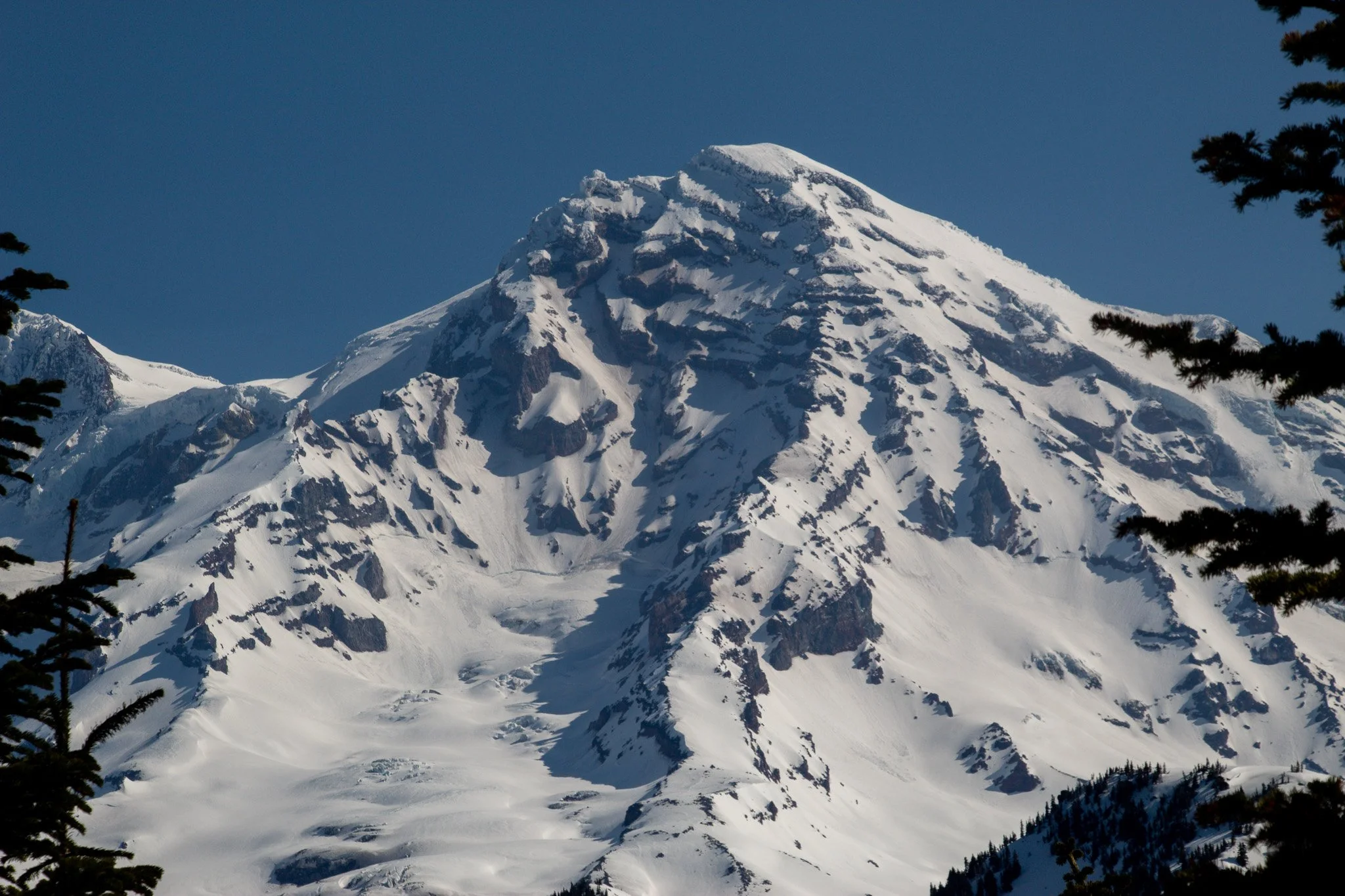
The Success Cleaver is center/center right. The Kautz can be seen on the far right.
Slowly breaking through tree line, we finally got our first glimpse of the route as we descended down and past the Indian Henry Cabin. Making our way up and around the west side of Pyramid Peak, it was late morning with the sun glaring, and it was hot! After getting around Pyramid Peak, we joined up onto the base of the Success Cleaver. One of the fascinating and appealing parts of this route is that it is not only the longest route on the mountain, but also the only route that leads to the summit without crossing a glacier. We made our way up the first 1,500’ of the Cleaver in the the hot afternoon sun. Around 8,200’, it flattened out for a good football field length before the route become steeper and more sustained.
We had debated trying to make it to another bivy spot at 10,600’, which is where the exposed ridgeline section of the climb ends, traversing over to navigate through the cliff bands, eventually joining with the Success Couloir and upper Kautz Headwall. We decided to camp at this spot instead, as we were not stoked on skiing down with heavy packs, and this spot allows one to easily get back to camp via a short uphill ramp after skiing down the Success Couloir. If you were to continue to bring overnight gear past this point, you would want to carry it with you the whole way, otherwise it would require a good amount of downclimbing and traversing to retrieve it.
Low winds and clear skies made for classic views and peaceful dinner before getting an early bedtime. Cody and I shared a Black Diamond Firstlite, while JT used his Outdoor Research Helium bivy.

Cody organizing his gear for the morning. Mt. Adams stands out in the background.
Waking up the next day, we set out around 4am. The route steepened and lead to some of the best and most memorable climbing I’ve had on Mt. Rainier, and in Washington. Steep firm snow, knife edge ridge, some 4th class rock sections, and sweet exposure for the next 2,500’ of climbing took us through sunrise. The climbing is exposed and consequential, several places a slip could be deadly. But the snow conditions were as good for climbing as you could ask for, and it never got too difficult. The sun had already been working on the snow, which in some of the steeper sections had formed nice easy steps you don’t often see until later season on the mountain. We each used two tools, one semi-technical and one lightweight skimo style. Although some may not need two, it made the climbing feel very secure and comfortable without needing to rope up and protect anything.

JT silhouetted against the sunrise

Dealers Choice - I went up and over a short rock section, while Cody dropped into a steep snow chute to get around
Just below 11,000’, we traversed underneath rocky cliffs, leaving the ridgeline proper, and into the Fickle Finger of Success. This was a nice booter for the next 1,200’ before joining the upper Success Couloir and into the exposed section above the Kautz Headwall. Around 13,000’, the nice booting conditions we had gave way to a crust. Then back to firm, then ice, and everything in between. Although it was not bad for climbing, the variable conditions, all above a 1,000’+ drop off of the Kautz Headwall, was not ideal for skiing. We continued on, knowing we could always downclimb.
The last bit of the route above 13,600’ gets a little tricky. At this point the exposure is awesome, and you feel like you could throw a rock down onto the Kautz Glacier Route below. We actually saw a solo skier making his way up it as well - the first person we had seen the entire time.

JT and Cody in the Fickle Finger of Success, or the West Success Couloir, around 11,600’
Going up the correct point here is important, otherwise you’ll find yourself staring up at a chossy wall and backtracking. After ascending up a bit, a long traverse brought us to a section involving a nice rock-hug move (be careful, don’t trust any rock on this mountain!) and the final steep chute. This is the section that people often rappel while skiing down. I’m not sure if it was just conditions that we had, but this section definitely would be troublesome coming down, and either rappelling off a deadman/snow bollard a time or two and some downclimb traversing would be required. The snow was gullied out and icy, not something I would even want to side slip down. Along with the small rock traverse, I see why this ski route is not as popular as the Finger. Or maybe we just went the wrong way? Either way, we were almost to the top.
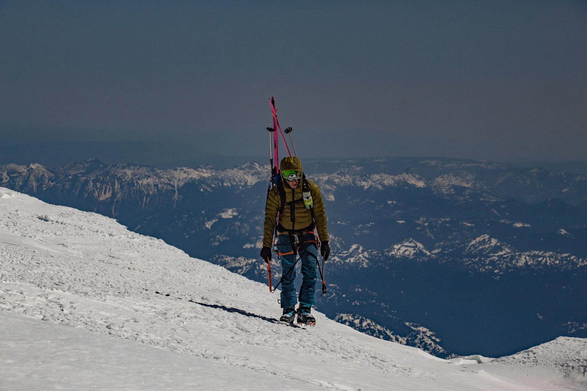
JT topping out on Point Success, 14,100’
We topped out on Point Success a little after noon. We were in no rush, as the upper mountain was quite firm, and wanted to descend around 2-3pm to ski some corn. After taking in the views, we made the longer-than-it-seems slog over to the crater. We breifly roped up, although probably unnecessary. This section doesn’t seem to get crevasses, and I’m not sure what is or is not officially “glacier”, but I do know you don’t have to stray very far to be next to the massive crevasses that the upper Nisqually has. If you do a straight line from Point Success to Columbia Crest, you *should* be fine.
We hit the “new” summit (based on the survey done by Eric Gilbertson in September, 2024) and dropped into the crater for a nice break. Since hitting Point Success, winds had been <5mph. It was the best summit weather I ever had, and we enjoyed being able to just relax, eat, and enjoy the views.
At this point, we discussed options. None of us were very stoked about skiing the Success Couloir. The upper part would take a while to rap and downclimb, and then would lead to a thousand feet of exposed skiing in variable snow. Add in smoked legs for the cherry on top. We talked about skiing down the Fuhrer Finger, and then traversing back over to our campsite, but in our wisdom had left our skins at camp. That would lead to a long night back to the cars. Luckily, the next few days of weather would be just as nice, and JT and I had them off, so we figured we could head back up and collect camp in the next day or two. So, after a nice break, we started down the Fuhrer Finger to make our way to Paradise.
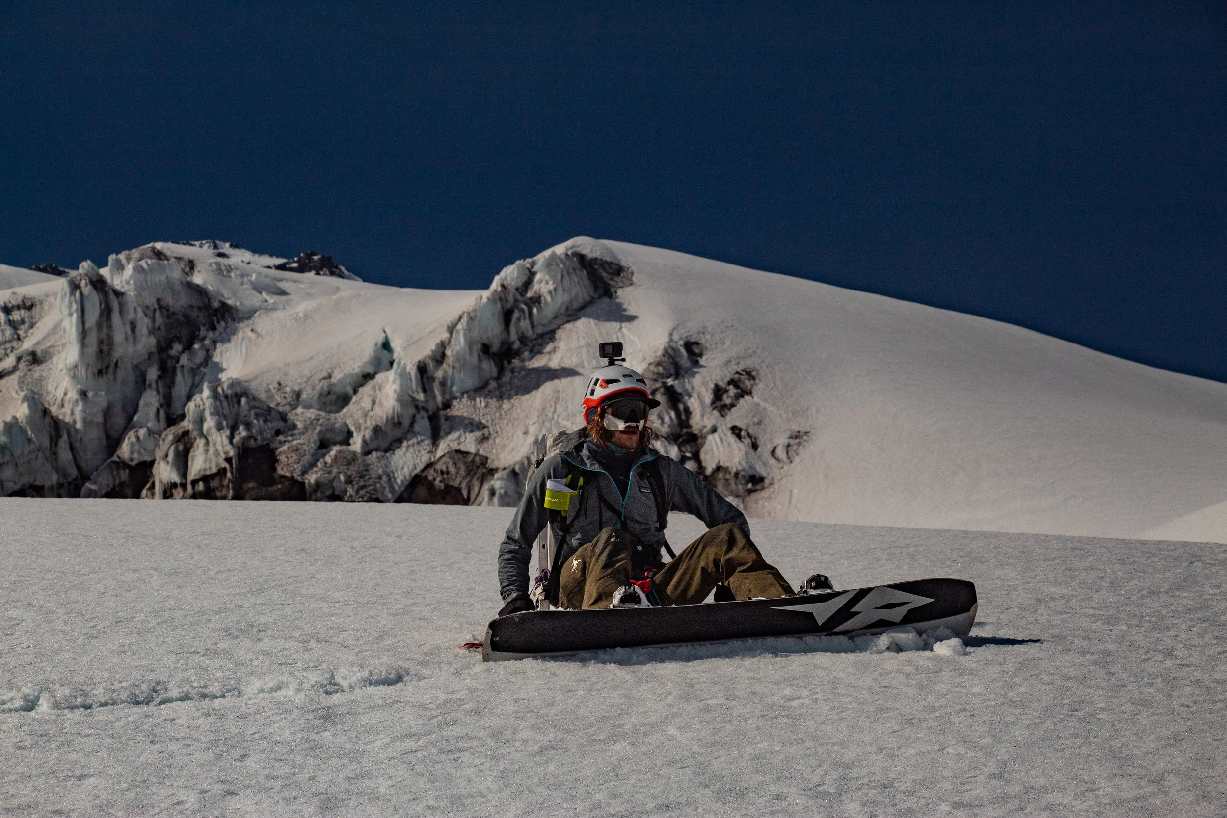
Split boarders love Mt. Rainier. With few transitions, they actually can keep up. Cody takes a break on the lower Wilson Glacier.
Skiing down from the summit, onto the Upper Nisqually, and into the Fuhrer Finger was straightforward this early in the year. There were a few little openings we could easily ski over here and there, and getting from the Upper Nisqually to the Finger was a straight shot, unlike when Shannon and I did some shenanigans while skiing it in June. The views were great and we could see the ant line down on the Muir Snowfield. It was very close to being a perfect descent, except for one thing. The snow never softened. We skied firm, vibrating snow most the way down, making our tired legs even more tired, before finally hitting the good stuff on the last few hundred feet of the couloir.

Cody enjoying the soft snow
The rest of the journey was straight forward, finally enjoying some corn. A short boot pack up out of the Nisqually drainage and we soon found ourselves at the Paradise Parking lot. I befriended a skier who had done the Muir Snowfield twice that day to drive me back to my truck at Kautz Creek. I drove back up to pick up the other two, and we were on our way.
Two days later, JT and I returned to the Kautz Creek trailhead with 5 lb. packs, light skis, boots, and headed up to retrieve our camp. We made it in about four hours, three hours faster than before. It’s always nice carrying light gear and when you know the way. Our stuff was still there thankfully, but JT discovered his bivy had some nice tears in it, which we are still a little puzzled on what actually caused it.
Skiing down on great corn from our camp for 1,500’ was a highlight before we started the uphill-both-ways trail. With mushy snow and constant ups and downs, we were glad we weren’t doing this under headlamp two nights ago. And the good thing is, now I have a story to tell my kids whenever they complain about having to walk somewhere.
Key Takeaways
-Later in the season, there will be more rock sections. The rock is pretty garbage. There are a lot of sections exposed to rocky cliffs and rock fall. I think this is a better early season route. It also does not require you to wait or plan around the Longmire Gate closures in early season/winter!!
-This route seems to have low traffic, but of the 6 routes on the mountain I’ve done, this is my favorite. It is long and more remote, so I don’t see this getting much traction. This was Cody’s first time summiting, a pretty impressive first route to do it on.
-If you want to do an up and over, I would recommend a 3 day schedule, camping at the 8,200’ site and the 10,600’ site. Two days would be nice if you actually plan to ski the Success Couloir.
-It’s great for physically fit teams looking to get away from crowds. I would love to do this route in a single day traveling light. You should be comfortable with exposure and crampon technique. If you were to pitch out the ridge and upper section, I would recommend the 3 day schedule.
-You can also approach from Longmire or the Westside Road. I think Kautz Creek is the way to go, but the other ways are similar.
-From Kautz Creek trailhead, it is about 11 miles and 12,800’ of gain to the summit.


